Mapping Resources
Mapping IP Addresses in Bulk - Geocoding IP addresses
Guide
Learn how to quickly convert a list of IP addresses into geographic locations and use them for mapping and visualization.
Read MorePlot Latitude and Longitude Coordinates on a Map
Guide
Learn how to plot latitude and longitude coordinates in bulk using Maptive's geocoding capabilities.
Read MoreCreate A Custom Google Map With Your Excel Mapping Data
Beginner's Guide
Learn how to create to use your excel data to create a custom Google map using Maptive in only a few minutes. Customize your markers, labels, base map style (Default Google Style, Satellite View or your own custom styling).
Read MoreCreate a Pin Map
Beginner's Guide
Learn how to create interactive pin maps from your location data in no time. Customize the appearance of your pins and the data displayed.
Read MoreWhat is an isochrone map?
Article
Learn what an isochrone is and how isochrones are used in mapping.
Read MoreHow to Drop a Pin on Your Interactive Map
Beginner's Guide
One of the best features of any interactive map is the ability to drop a pin and mark a location quickly and easily. Maptive uses Google Maps to make this process easy, allowing you to click anywhere on a map to create a new location marker.
Read MoreHow to Map Customer Locations
Beginner's Guide
Learn how to Map customer locations with Maptive's mapping software. Combine your proprietary data with our customizable maps and demographic data for powerful analysis.
Read MoreCluster Maps: What Are They And How Do They Work?
Article
Plotting your data onto an interactive map reveals new insights that wouldn’t otherwise be available to you. But if you’re dealing with an especially large data set it’s important to reduce the amount of visual information displayed to you at once.
Read MoreCalculate the Area and Perimeter of a Location on a Map
Article
There are a number of scenarios in which you may need to quickly calculate the perimeter or area of a given location on a map. Luckily, today’s tools and technology make this a simple task as long as you’re using the right software.
Read MoreCreate a Population Map of Canadian Provinces
Beginner's Guide
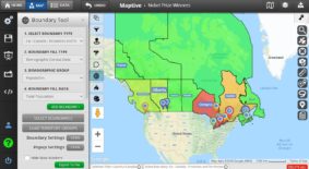
Learn how to create a Canada population map with Maptive. Use our mapping software to uncover valuable market insights to develop strategies for future growth.
Read MoreCreate a US Population Map with Maptive
Beginner's Guide
Determing population density and demographics of a target market is valuable for almost any business. In this Beginner's guide we show you how to create a U.S. population map to see population numbers from census data.
Read MoreCreate Custom Maps For Presentations
Beginner's Guide
Learn how to create custom, high-quality maps for PowerPoint presentations (or any other sort of presentation. Export maps as images or PDFS or use presentation mode to turn your data into interactive maps that show the big picture.
Read MoreExport Zip Codes Within a Radius in Minutes
Beginner's Guide
Need to know what zip codes are in a given radius? Use Maptive’s Distance Radius Tool to highlight an area of your map and export the zip codes within it.
Read MoreCreate a Map Legend
Beginner's Guide
Map legends and keys allow viewers to understand the map elements they’re looking at. Use Maptive’s grouping tool to represent your map's data points.
Read MoreHow to Use Maptive to Create Postal Code Maps
Beginner's Guide
Maptive is a global mapping software with postal code mapping features for nearly 20 different countries. Perform comparison analysis and territory mapping.
Read MoreHow to create an interactive map in minutes
Beginner's Guide
Create interactive maps to share with colleagues or embed on a website. The possibilities are endless: discover customizable, interactive maps with Maptive.
Read MorePlot Multiple Locations on a Map
Beginner's Guide
Plot points on a map in just a few clicks. With Maptive's mapping software, map multiple locations at once: anywhere from 1 to 100,000 addresses on one map.
Read MoreThe Best Way to Create a Custom Google Map
Step by Step Guide
Custom Google maps give you the ability to share valuable insights with team members, decision-makers, and customers. Find out more with Maptive.
Read MoreMake a Zip Code Map From Your Data
Beginner's Guide
Maptive can map your data within the boundaries of nearly 42,000 zip codes in the United States. Create zip code heat maps and customize to match your data.
Read MoreMap Coordinates: Find Locations by Latitude and Longitude
Guide
If the only location data you have are longitude and latitude coordinates, Maptive's reverse geocoding capabilities will map coordinates to addresses.
Read MoreShare, Embed, and Export Your Maps on Maptive
Beginner's Guide
How do you share the insightful maps you create in Maptive with your clients or team? Maptive makes it easy to share, embed, and export your maps.
Read MoreDisplay City Boundaries on a Map
Beginner's Guide
Learn how to create a US city map with boundary lines using Maptive's software. Upload your data and aggregate by city to find insights about your business.
Read MoreCreate a World Map with Countries
Beginner's Guide
Create a custom world map with the names and borders of all the countries labeled. Upload location data, and Maptive will build the world map for you.
Read MoreHow to Create a US State Map
Beginner's Guide
Display US state borders on a Google map. Add your own data to the map or use the US Census Data included in Maptive to find information about each state.
Read MoreWhat are Choropleth Maps?
Article
Learn what a choropleth map is & how to use color-coded choropleth maps to take a high-level look at your business and detect regional patterns .
Read MoreWhat is Geo-Mapping? Make Sense of Your Location Data with Geo Maps
Article
Use Maptive to plot your location data on an interactive geo-map, and bring the information you’ve collected to life in clear data visualizations.
Read MoreWhat is GIS software?
Article
GIS software comes in all shapes and sizes. Find out how Maptive's GIS mapping software can fit your needs and produce customizable maps from raw data.
Read MoreWhat Is Location Intelligence?
Article
Location intelligence identifies the geospatial relationships in your data. Maptive is location intelligence software that drives business insights.
Read MoreHow to create Topographic Maps
Article
Learn how to generate topographic terrain maps using Maptive and how to read the elevation of geographical features on them.
Read MoreMap Multiple Locations on Google Maps
Guide
Learn how to quickly and easily map multiple locations on Google maps using Maptive.
Read MoreCreate a Territory Map with Zip Codes
Guide
Learn how to use the geographic boundary tool to create zip-code-based territory maps.
Read MoreCanada GIS Mapping Software
Article
Learn more about Maptive's Canadian GIS mapping capabilities.
Read More